

How to reach Politecnico
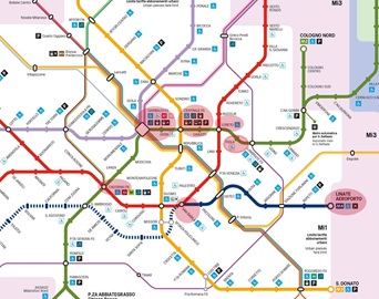
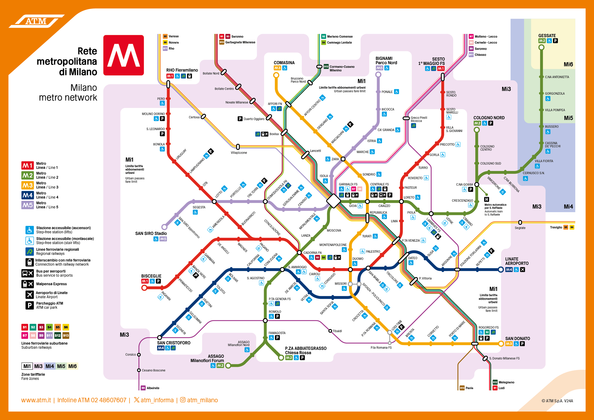
The conference venue is served by several bus and tram lines and by the metro stations Piola (M2, green line) and Loreto (M1, red line); see the metro map below
Detail of the map of Milan’s subway lines. Highlighted in red are the main stations useful for connections to reach the conference venue. See links to the right for full metro map and further details of public transport in Milan.
Train stations
The train stations offering international connections are Milano Centrale, Milano Garibaldi, and Milano Cadorna. These are all located along the the M2 (green) metro line, offering a direct connection to the stations of Piola and Loreto.
Airports
The international airports of Malpensa (MXP), Linate (LIN) or Orio al Serio (BGY) airports are well connected to the Milan city center and to the conference venue:
Malpensa airport (MPX): the airport is connected by a direct train (Malpensa Express) with the metro station Cadorna (located along the M2 green line); moreover, a bus (Malpensa Shuttle) connects the airport directly to Milano Centrale.
Linate Airport (LIN): the airport is connected to the conference venue by the M4 and M1 metro lines: directly from the airport, one can take the M4 metro line (the blue line), change to San Babila to the M1 metro line (red line), and reach the Loreto station; moreover, a bus (Linate Shuttle) to Milano Centrale is also available.
Orio al Serio Airport (BGY): this is the airport of the city of Bergamo. The airport is connected to Milano Centrale by several bus lines (e.g., the Terravision Bus and the Orio Shuttle).